Digital Planning
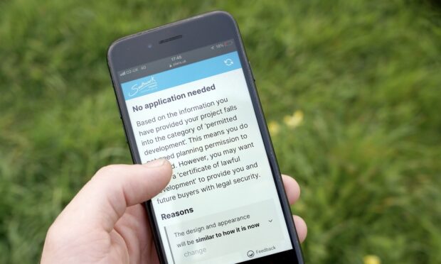
Local planning authorities are modernising planning services using open data. New software like PlanX is improving the experience for applicants, while back-office improvements are speeding up processing. New funding will help more authorities adopt tools and make improvements, freeing up planning teams to focus on delivering the homes communities need.
What turns a case study into something people can use? Insights from local planning authorities shaped a user-centred approach to a series of digital planning case studies, helping them sit alongside plan-making guidance, support peer learning and build confidence in how planning teams use digital tools.
We’re exploring if AI can help support faster local plan preparation. An AI tool developed by Greater Cambridge Shared Planning and the University of Liverpool is now being stress-tested by 5 local authorities, to see if the initial results – accurate consultation summaries produced in a fraction of the time - can be replicated elsewhere.
We've completed the first phase of testing new data standards for planning applications. Working with local planning authorities, software suppliers and the Planning Portal, we examined how draft specifications align with real systems and workflows. The result? A clearer understanding of what works and what needs refining before wider implementation.
Planning data locked in PDFs and legacy systems creates barriers for everyone. This February, 49 more local planning authorities are joining the Digital Planning Improvement Fund to publish essential planning data in open, standardised formats making it easier for residents, businesses and developers to find what they need.
Every year, local planning authorities make hundreds of thousands of planning decisions. Right now, planning decisions are recorded in dozens of different formats. Find out about the work taking place to change that by creating a data standard for planning decisions.
Read about our year transforming England's planning system through new partnerships, innovations and momentum. Everything we do aims to give communities a planning system that is data-driven, efficient and accessible, supporting the government's mission to deliver 1.5 million homes this Parliament.
Read about the details of a new plan-making system for England. It will ensure local plans, which are created by councils to shape development in their area, are simpler, faster to prepare, and more accessible for everyone. Learn about new user-tested digital guidance and tools published in draft to help plan-makers deliver local plans faster.
Modernising planning relies on standardised data that enables digital systems to communicate effectively. The Digital Planning programme is funding 5 pilot projects with local authorities and software suppliers to test emerging data standards for planning applications. Read about how these partnerships will help create more transparent and efficient planning services across England.
User research is underway on standardising planning decision notices. Local authorities currently use different formats to record planning application outcomes, but standardisation would make crucial data instantly available for effective planning, analysis and forecasting. The data standards community has been providing invaluable feedback on where standardisation can deliver the biggest positive impact for the sector.